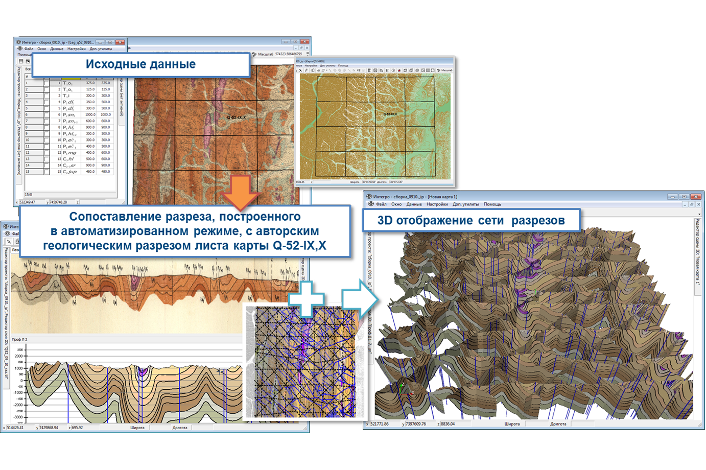
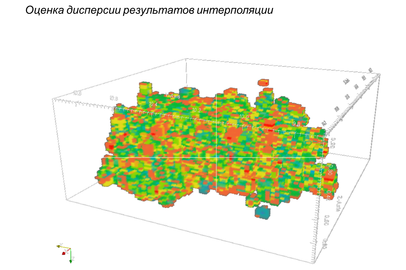
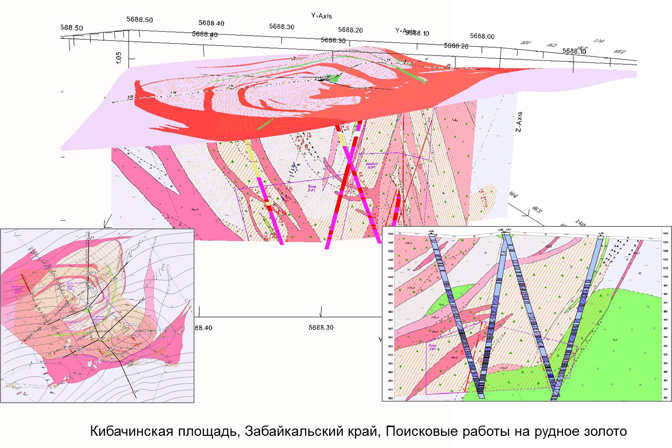
The block GIS INTEGRO-3D provides extended possibilities for 3D-visualization and 3D geological modelling. The tools include 3D-viewer for vector and grid data, utilities for automatic compilation of cross-sections, working module for 3D-visualization of wells with consideration for inclinometry. The technology supports synchronous editing of vector data in several scenes.
Main possibilities
Visualization and processing of any data concerning wells in one-dimensional, two-dimensional and three-dimensional form
Matching and simultaneous editing of several sections in their crossing-points
Matching of seismic and geological sections and of the results of geological interpretation by profiles
Building of structural surfaces on the basis of isoline maps, or wells data, or sections grid, or the whole complex of data
Combined 3D-visualization of 3D models (cubes), surfaces, profiles and wells
Automatic building of geological sections by specified profile or by grid of profiles on the basis of a digital relief model, or geological map, or data on rock occurrence thickness
The tools of this block permit to realize the following main tasks of geological 3D modelling
-
Compilation of 3D models of excess density and effective magnetization intensity
-
Selection of objects with anomalous geophysical characteristics in the sedimentary cover
-
Preparation of structural, structural and tectonic maps and schemes through the processing of potential fields and Earth remote-sensed data
-
Building of geological sections by specified line
-
Matching of the grid of retrospective geological seismic profiles
-
Building of 3D structural frame
-
Building of structural surfaces of sedimentary cover on the basis of seismic data, geological maps and drilling data
-
Verification of retrospective structural maps using the data concerning wells and profiles
-
Building of 3D model of sedimentary cover using structural surfaces
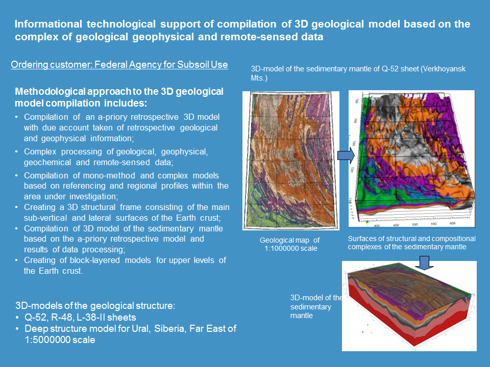
On the basis of the block possibilities the technology of three-dimensional modelling of geological structure of subsurface sites is realized. Geological and structural tectonic maps, wells data, seismic, petrophysical and geochemical information, areal results of gravity and magnetic survey, spectrozonal aerospace images are used as source data for modelling.
The main stages of the technology include:
- clarification of structural maps of surfaces in the sedimentary cover and the surface of the basement using seismic and wells data for the district of the works
- clarification of the regional structural tectonic backing using the results of gravity and magnetic measurement and remote-sensed data.
- clarification of the surface geometry of the upper part of the section with the contrasting physical characteristics in the interprofile and interzonal space using the high-precision data of gravity and magnetic measurement
- building of 3D structural tectonic frame of the territory (block-layered model)
- filling of the block-layered model with physical characteristics: density, magnetization, velocity, if applicable)
- verification of the concordance between the physical block-layered models and the real data by the means of solving direct problems of gravity and magnetic measurement, models editing
- compilation of physical geological models by the means of solving classification problems and geological interpretation
The compiled physical geological models can be used in the prognostic investigations for different kinds of mineral resources and in the planning of geological surveys.
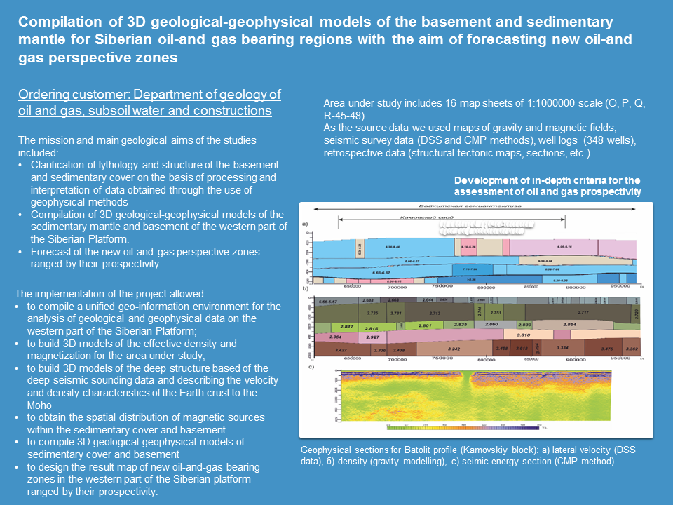
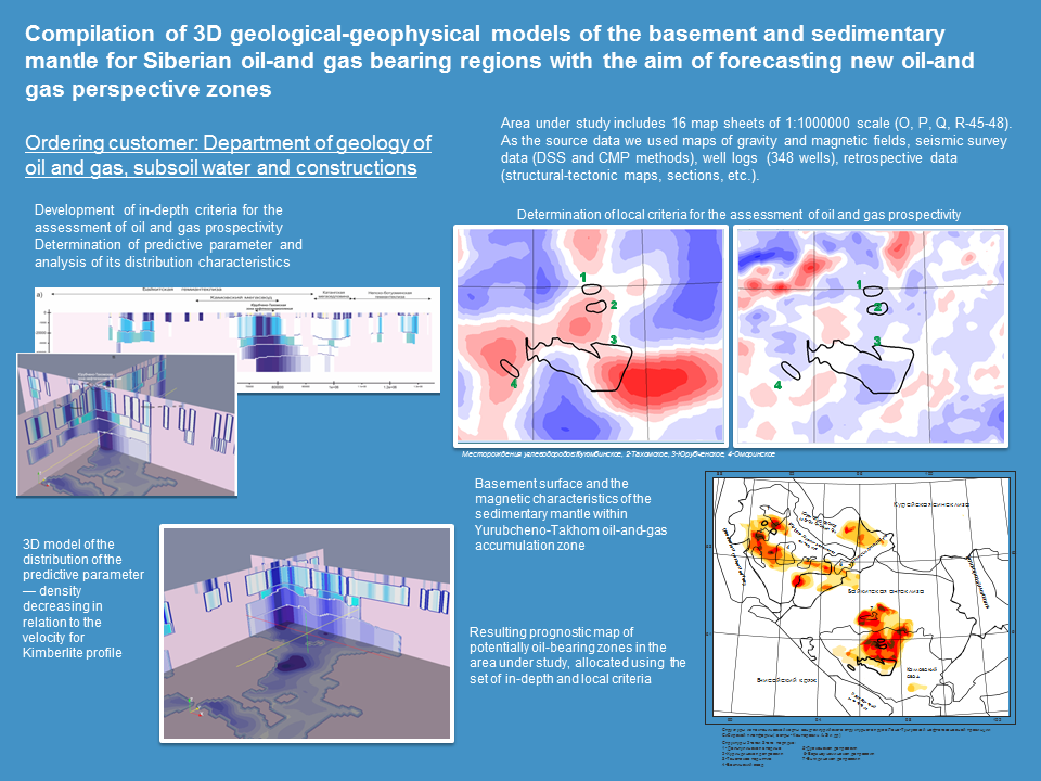
With the use of 3D modelling in GIS INTEGRO the following projects were successfully realized: the geological geophysical model based on the regional profile 8-DV (for Russian Geological Research Institute), the deep structure model of Volga-Ural oil-and-gas bearing region and Yenisei-Khatanga regional downfold (for All-Russian Research Geological Oil Institute) and others.
Examples of the projects realised in GIS INTEGRO
